Day 106 - Friday, July 16, 2021
It looks like it’s going to be another good day; clear skies and in the 80’s. A tad warm for hiking but it is the summer time. It is a little cooler in the higher elevations and hiking under the forest canopy is a godsend; being protected from the direct sunlight. The temperatures are at least 6 - 7° lower.


Today we are officially entering the White Mountain National Forest commonly known as the “Whites”. The next 2 weeks will definitely be an adventure! We are hiking from High Street (1795.5 NoBo) to Lost River Road, NH 112, Kinsman Notch (1803.7 NoBo) equaling 8.2 miles. It is a shorter hike but it is not a “Nero” by any means. We are going over Mt. Moosilauke which is a 3400 ft climb noted for its steep rocky slopes 😬. The total change in elevation will be over 5300 ft.
We began hiking at 10 am and it was already warm, 74°.


This sign was posted at the bottom of the trail approaching Mt. Moosilauke …”This trail is extremely tough, please take another trail… avoid tragic results.”😬😲🤔 and you’re telling us now 🤫. The only alternate route is to turn around… Now I’m wondering if my life insurance policy is still in effect?


Hmm.. now which way do I go?

How about that way…

Or this way…


That’s the trail on the left.


I was told by two different people to be safe out there. I don’t think the word “safe” was in today’s vocabulary. This climb was 3.8 miles long and went to elevation 4802 ft (+3400 ft change in elevation) 😵💫😳.


We are above the tree line, cairns marked the trail.

Which got us to the summit of Mt. Moosilauke. As you can see, visibility was zero and there was a 30+ mph wind. I made a “noob” mistake and didn’t bring any additional clothes or goretex to put on at the summit. Thankfully it wasn’t that cold. I didn’t expect this at 4800 ft. I will definitely have cold weather gear in my pack the remainder of the hikes through the Whites. Conditions were much milder south when hiking through the Great Smokys and we were 2000 ft higher 🤔.

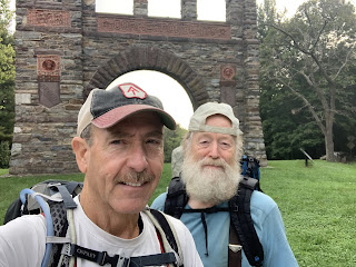
This section of the mountain is owned by Dartmouth College and the trail maintenance is done by the Dartmouth Outdoor Club. Here is a couple members of the club.


We quickly made it over the summit and back into the protection of the tree line.

We would have missed this turn if it wasn’t for the sign indicating a turn. There are many secondary trails in NH that are maintained by local hiking clubs. These trails also have local names which supersede the AT signage which can sometimes be confusing.


While traversing down the trail coming from Mt. Moosilauke my trekking pole got stuck and subsequently bent. I straightened it the best I could while being on the trail but I think this pair of trekking poles will be retired before I hit Mt. Washington. I can’t afford them to break on this segment of the AT.

Just to give you a perspective of today’s climb, this is Mt. Moosilauke looking up from NH 112.
We finished hiking at 5:00 pm. There was a slight shower on the way down but it only lasted a few minutes.
Till next time... Happy Hiking 🥾
😋
“Acts of generosity in this wild and primitive setting…where basic amenities…are intentionally absent–are often received in a heightened sense of wonder and gratitude by hikers. These acts of generosity are referred to as “trail magic.”
(Appalachian Trail Conservancy)


Phew! I just finished reading all 106 blog posts and now I’m caught up to 7/16. That alone was a huge undertaking! 🙂 Splinter, can you check and see if the AT gives out awards to “Premium slack blog readers? 😂 Kidding aside, I’m totally in AWE of you and Turtle Power for making it this far! Through rock scrambling, roots, mud, rain, fog, humidity, cold, heat conditions and more, you guys are doing it!!! Keep going and stay strong!!! 2190 !!! YOU CAN DO IT!!! 💪🏼
ReplyDeleteThat should not be called a trail. Crazy I don't know how you're doing this...
ReplyDelete