Day 72 - Saturday, May 22, 2021
Woke up at 5:30 am so we could get ready and be boots on the trail by 8 am. Today’s forecast is again going to be hot and dry. I checked the AT Guidebook and there are ample locations to resupply water on the hike. I’ll start off with 3L of water in my hydration reservoir.
Today we resumed hiking from Devils Fork Gap, NC 212 (311.0 NoBo) to NC 208, TN 70 Allen Gap (289.7 NoBo) for a total of 20.3 miles. This will be our single longest hike to date as there is not any parking closer. Only other option was to camp overnight but we’ve done 19+ miles before... Just a walk in the woods 😉.
We began hiking at 7:45 am and started our hike with another big ascent; nearly 8 miles long and +1900 feet in


All the mountain vegetation and tree canopy has exploded the past 3 days with the warmer weather. Everything is fully bloomed... except the rhododendrons.

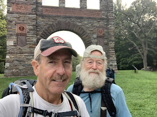
This is “Frosty”; he left Springer on April 16th. He warned us of a bear he just saw up the trail and a hard climb he had coming through the “Ridgeline”.

The never ending rhododendron tunnels. They should all be in full bloom in another week.


One of the longest step sections that we have encountered. I am still in awe of how labor intensive it must have been building sections of the trail!

And this is “Fresh Prince” who left Springer April 20th. He is a grad student studying Recreational Therapy. He did his undergraduate in IT. He has to finish by late August to be back for school... he has to start racking the miles up to meet his deadline but it is feasible. Happy Trails “Fresh Prince”.


We didn’t realize what this blue trail was until we hiked Big Butt. This turned out to be a section of trail that avoided Big Butt which was a very technical and difficult section of rocks climbing and scrambling. The bypass is not the designated AT so it wasn’t even an option for us to take it 🤔. Sorry, no pics as we were a little preoccupied climbing 🙄.

I wonder how many hikers have their ashes on the trail? Seems appropriate to me considering all the blood, sweat and tears they already left on the trail hiking it.


Replenishing water. There hasn’t been any issues finding water on the trail when needed. Refreshing mountain spring water... I would drink piped running water untreated if I had too 😉.

This is the northern end of the “Ridgeline”. The “bad weather trail” blue trail was an original section of the AT.

Traversing the “Ridgeline”.


More of the “Ridgeline”... and this was nothing compared to Big Butt.

Howard’s Rock on the summit of the “Ridgeline”.

The history of Howard Rock. Enlarge to read ... very interesting how this section of trail was built. In case you can’t read it, it describes how Howard McDonald built this 1.4 mile section of trail taking 5 years to complete it in 1990. The origin AT which is now designated the “bad weather trail” was on the mountains southwest side and did not provide the views that the “Ridgeline” does.


Views from Howard’s Rock... spectacular!


This is “Pocket” who started from Springer on April 19th. He admits he had a slow start but hopes to pick his daily mileage up. I wonder if his kilt is slowing him down 🙄.


The Little Laurel Shelter.
We finished hiking at 6:15 pm. The sky was clear and the temperature got to 78°. We stopped twice to replenish our water. I drank nearly 4 L of water. Today was a hard but rewarding hike...
Till next time.... Happy Hiking 🥾
😋
“You gotta have passion for life and passion for something that you're going to get up and do,".
Meredith “Sunny” Eberhart


Comments
Post a Comment